Illustrated Maps

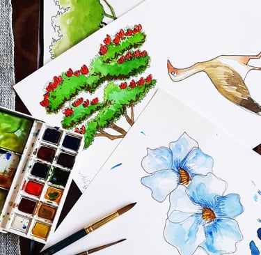
In my years working as an architect, I was able to refine my perspective on my surroundings and developed a special passion for illustrated maps.
My illustrated maps are unique pieces used to tell a story and capture the essence of each place. Their aim is to facilitate location while also enchanting and visually engaging.
To craft an illustrated map, I typically use a digital cartographic base such as Google Earth and design the layout by arranging the spaces to highlight the information that my client wishes to showcase—without adhering too strictly to a technical scale.
Rafting Rio do Turvo
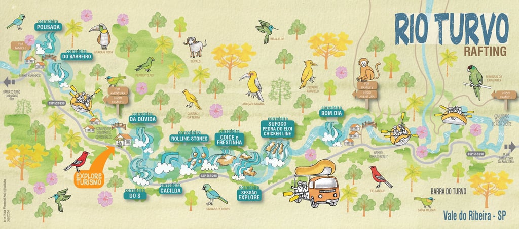
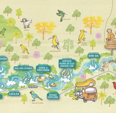
This project was created for Explore Turismo, a company providing rafting experiences in the Vale do Ribeira region, in the south of São Paulo State (Brasil). In addition to offering information about the rapids of the Rio Turvo, the map is designed to showcase the rich flora and fauna of the area, helping guides make the adventure on the Rio Turvo even more engaging for visitors.


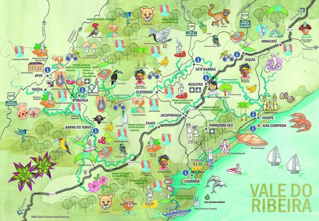
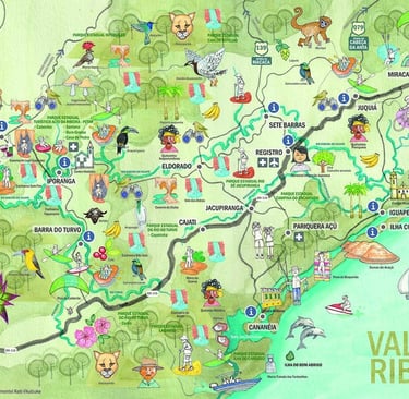
Vale do Ribeira
This contribution was developed for tourism entrepreneurs in the Vale do Ribeira region, São Paulo. The goal was to create a map that reveals the area’s unique tourism potential and inspires visitors and investors to discover the region’s possibilities.
The map was officially launched at the Encantos do Ribeira tourism fair in Registro, in the Vale do Ribeira region.
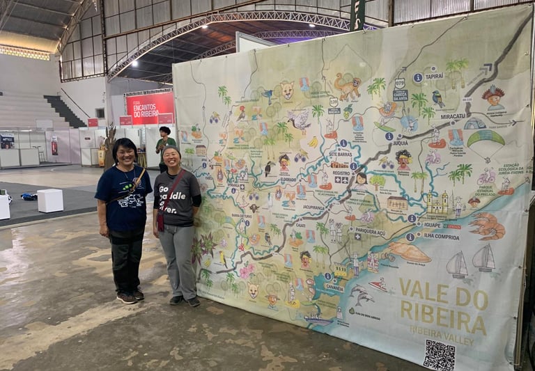
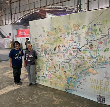
The map was officially launched at the Encantos do Ribeira tourism fair in Registro, in the Vale do Ribeira region.


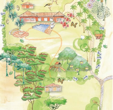
Fazenda in Londrina
Illustrated map for a family event held in Londrina, Paraná (Brazil). The goal was to create an emotional map of the estate, emphasizing the family’s strong connection to the place, evoking shared memories and strengthening bonds—making the event as special as possible.


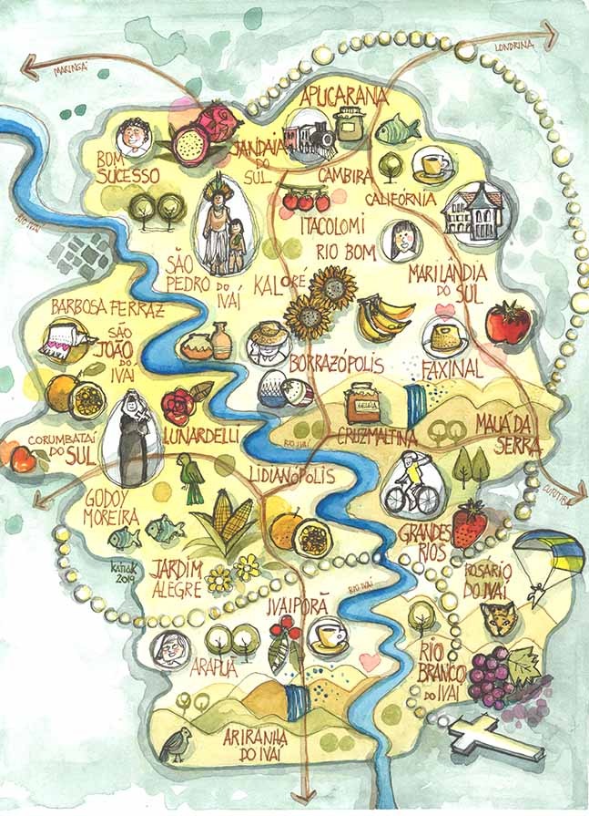
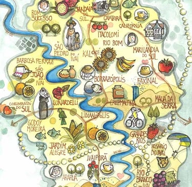
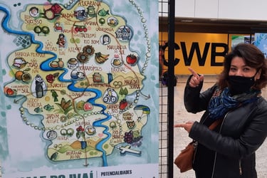
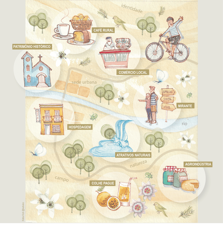
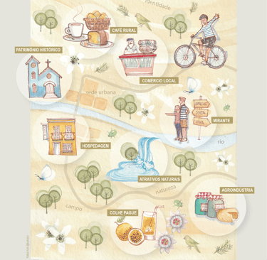
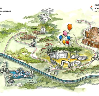
Illustrated map designed to support the development of a regional project in the Vale do Ivaí, Paraná, Brazil. The idea was to bring together the region’s unique features and possibilities in one illustration, highlighting its richness and character, and facilitating community discussions. The map continues to be used for years now at local events throughout the region.
Potential of the Vale do Ivai Region
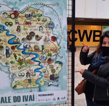
Exhibition Vale do Ivaí - Afonso Pena Airport
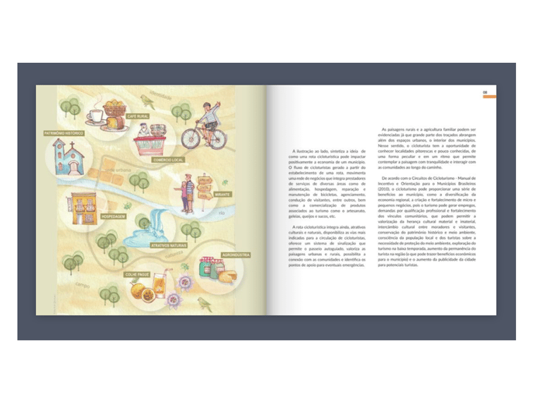
Cycling tourism Network
Illustrated map created for the Planning Manual for cycling routes, a publication by the government of the state of Paraná. The aim was to visually and playfully demonstrate how cycling tourism can enhance appreciation for the region and, at the same time, contribute to its local economic development.


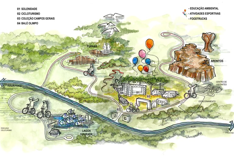
Parque Estadual de Vila Velha
Illustrated map for the World Cup event - 2014
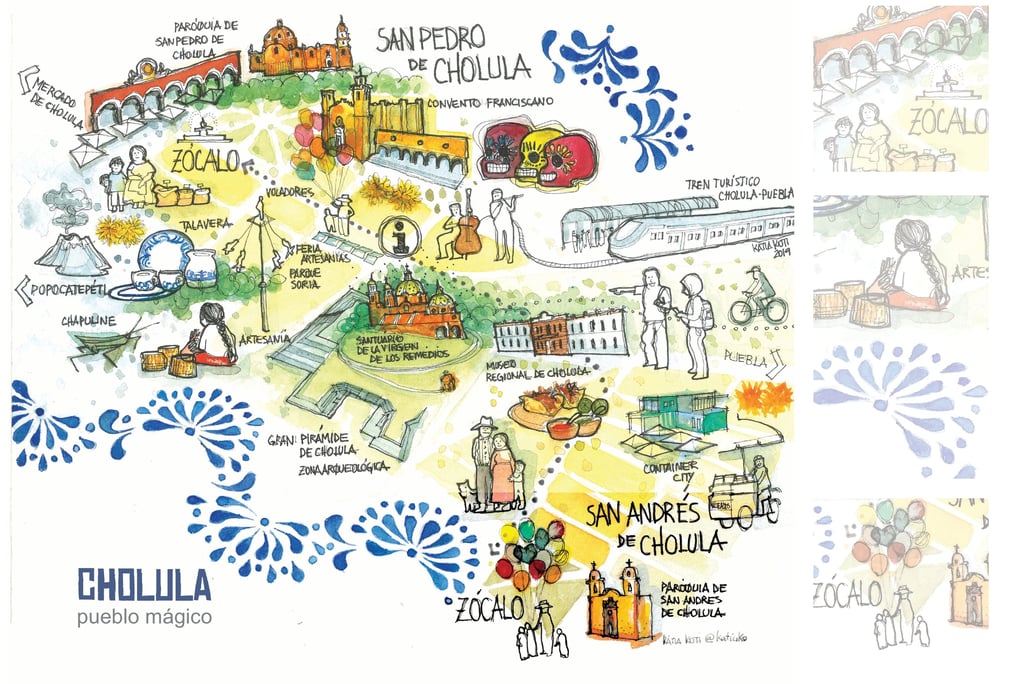
Cholula - Mexico
Illustrated map for the historic center of Cholula, Mexico. Personal project.
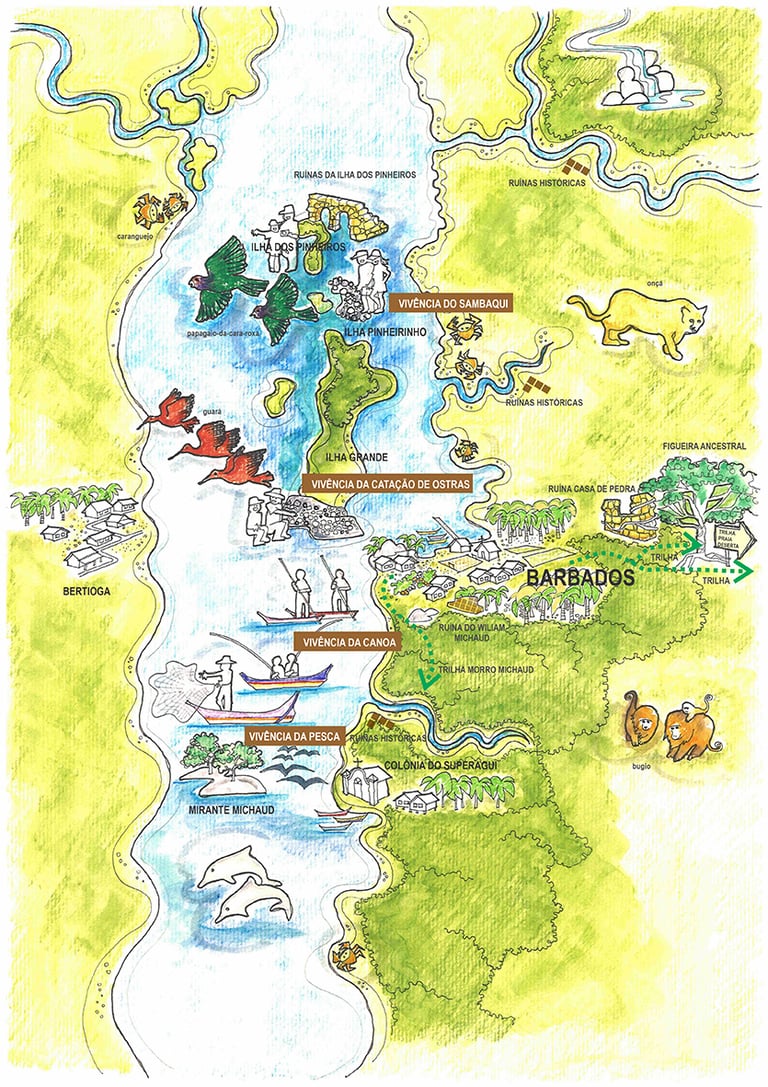
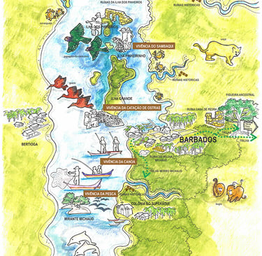
Barbados - Paraná
Illustrated map for Undergraduate thesis in Tourism - Federal University of Paraná. Student: Gabriel Coutinho